Finally visiting a ghost town! and photos of the inside of our trailer
Monday before we packed up I finally took some photos of the inside of the trailer since so many people have asked about it. Its messy, but here you go:
Bed slats for the air mattress.
Bed slats for the air mattress.
We put a 3in thick gel/foam mattress topper on top of this and then bed sheets and quilts but I do not have a photo of that.


We don't leave it this messy when its down and we are driving, that's just when I took the photo.


We don't leave it this messy when its down and we are driving, that's just when I took the photo.

I will try to get photos with the bed set up later but here is a video of the trailer lifting up and down as well https://youtu.be/vjKTVDBH20g
I tried to wash the engine oil off the trailer at the campsite carwash but it didn't work very well without soap. It seems to be a common thing in the north for carwashes to not have soap. The campsite had coin laundry facilities which were out of order and when i came down the hill to wash the car there was a festiva there! The electrician repairing the laundry uses a festiva as a work vehicle. We talked quite a while and he said he had every colour except black, 6 festivas if i remember right. After looking over my car and talking for half an hour or so he gave me his number in case I needed parts and he had to get back to work.
We went into Whitehorse and I dropped Julie off at the laundromat so she washed the clothes while I fueled up the car and went grocery shopping with the kids. Usually that works out alright and we are done about the same time however Julie forgot money and her phone in the car and had to walk to where I was shopping to get that and walk back. So that took longer and we didn't end up getting out of Whitehorse until 1:30pm. The length of time grocery shopping and laundry takes is something i badly misjudged when planning this trip.
We drove to Haynes Junction and stopped to see an old church that was made out of an army quonset. There was an older couple in a camper there who were quite interested in our camper and trailer. They had a look over it and he mentioned he had made his own water cooling system for the brakes on his RV so I had to have a look over his camper as well. It was quite a neat setup, they had modifyed a few things and had a pretty good system going as it sounds like they did quite a bit of travelling. They had overheated their rear brakes once to the point where they had to replace the entire rear axle so he tapped into the pressurized water system in his camper, ran a 1/4in hose to each rear brake drum and had a needle from a syringe on the end of each hose pointing at the drum. So when they are braking down a steeper hill the driver turns a ball valve near his seat on and quite a strong stream of water shoots at each drum. They just have to remember to turn it off before the bottom of the hill so that they don't warp the drums...
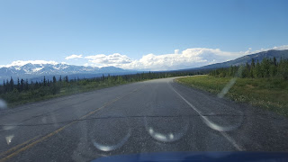
We left Whitehorse late and spent probably an hour talking to these people so now we were really late! The scenery was great after this as well.
Near Kluane Lake we got to the ghost town of Silver City. 40 years before the Alaska Highway was built, Silver City was the end of the road from Whitehorse, 215km away. It formed from a brief gold rush in the early 1900s. The first claim was staked in 1903 and within six months there were 2,000 claims staked in the Kluane lake area.
“Prospects looked so good that a Vancouver company planned to build a million-dollar railway from Whitehorse to the Kluane gold fields.” There were predictions that 10,000 miners would come to the area, but only a few thousand materialized at the rush’s peak. In 1904, the Mounties set up detachments in canvas tents on Ruby Creek, Bullion Creek and Pine Creek, before establishing a permanent detachment in a small new community called Silver City. By 1905, only a few hundred prospectors remained in the area. Despite the modest returns W.L. Breeze, an Englishman, sunk $300,000 in to the Bullion Hydraulic Company.
It was a move called: “one of the largest financial blunders in Yukon mining history.” In 1906, he pulled out of Bullion after finding just $1,000 in gold. By 1914, less than $40,000 of gold had been taken from the creeks and by 1915 Silver City had just one resident. It was abandoned until the Alaska highway was built 28 years later and some of its buildings were used by the men building the highway. So its either been a ghost town for 104 or 75 years depending on how you count it but these buildings were mostly built 115 years ago!
The riverbeds in the area are interesting. This time of year they are mostly dried up so they are gravel beds usually with high sides of pushed up rocks and gravel. This one was quite wide.
Kluane lake is the largest lake in the Yukon and is pretty interesting. 300-400 years ago an advancing glacier blocked Slims river on the south end which drained the lake to the Gulf of Alaska. The water level in the huge lake rose 30-40ft and drained out the north end instead to the Bearing sea. Eventually the glacier receded and the water level fell 30ft back and drained out Slims river again. You can still see where the old waterline was 30-40ft up on the slopes around the lake. Then in 2016 the flow was changed again, Slims river dried up and the lake is draining somewhere else now. The level in the lake dropped more and there is a large dusty area that used to be the lake bottom and there was quite the dust storm when we went through.
We fueled up in destruction bay (population 55) and drove around the town. It was a construction camp formed when the highway was built and got its name when a strong wind destroyed nearly the entire camp.
This is the place you would go if you got hurt within a 100km or so radius....
Not much further down the road was the much larger community of Burwash landing (population 72) where fuel was quite a bit cheaper than where I fueled up... The strech from destruction bay to burwash landing was nearly all gravel. I was quite surprised on this trip how much of the alaska highway was gravel. I was expecting a rough highway, but i didn't think it would be gravel. We stopped to see an old church there and drove around the town.
We drove on and started looking for places to camp along the road after a while. The first place we stopped was along an old abandoned section of the Alaska highway but the mosquitoes were way too bad.
We kept going but everything was swampland and full of mosquitoes. We stopped on the side of the road for supper when it looked like it was going to start pouring rain up ahead and we just kept driving after that.
Near mt. Logan is steele glacier which moved 15km in the summer of 1966. You can't see mt. Logan from the highway unfortunatly, but it is Canadas highest mountain, second highest in north america after Denali and is the 6th most prominent peak in the world. It also has the largest base circumference of any non-volcanic mountain on Earth.
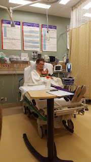
It was really late when we got to a campsite near the boarder, this is Julie realizing it is midnight and we aren't even ready for bed:
It is quite something for it to be this light out at midnight, you really don't realize how late it is.


Comments
Post a Comment